TC Coastal Inundation System
TC Coastal Inundation System#

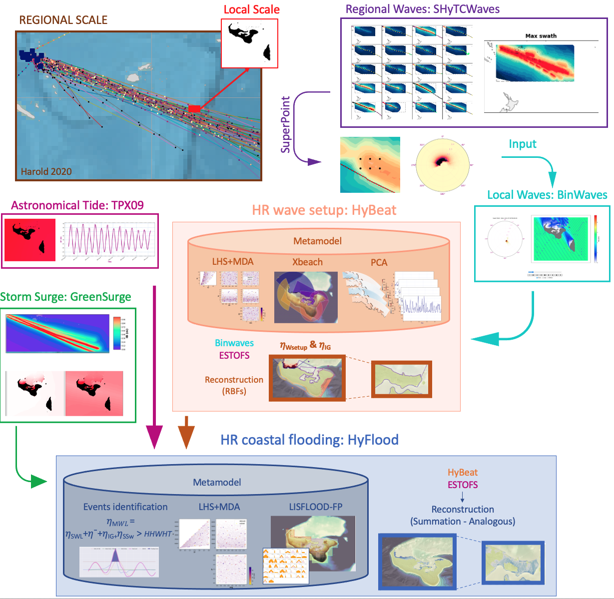
The TC Inundation System developed allows to automatically download TC tracks from the Joint Typhoon Warning Center and run a series of metamodels to derive the wave and storm surge associated to each track at a very high resolution at the coast, that coupled with a flooding metamodel, allows to obtain the flooding extents and its associated impacts.

For that purpose, and as shown in the sketch above, the system integrates a number of tailor-made metamodels developed for the region, that allow to eficiently downscale the information. The metamodels used are the following:
ShyTCWaves: This metamodel, based on a library of prerun cases of non estationary waves associated with 6h TC segments using SWAN third generation model, allows to generate the wave conditions associated to a tropical cyclone at a regional scale.
BinWaves: This metamodel, based on a library of prerun cases of monocromatic waves using SWAN third generation model, allows to downscale the offshore wave spectra obtained with ShyTCWaves to a local scale at a high resolution (~300m) and obtain the spectral wave parameters to be used by HyBeat
HyBeat: This metamodel, based on a library of prerun cases of representative wave conditions using XBeach, allows to obtain the wave SetUp produced at the coast and its associated infragravity wave at a very high resolution (5-20m), which is the input of the flooding metamodel named HyFlood
HyFlood: This metamodel, based on a library of prerun cases of representative hyetographs using Lisflood-FP, allows to obtain the flooding maps as the convolution of flooding events every 500m of the coast.

