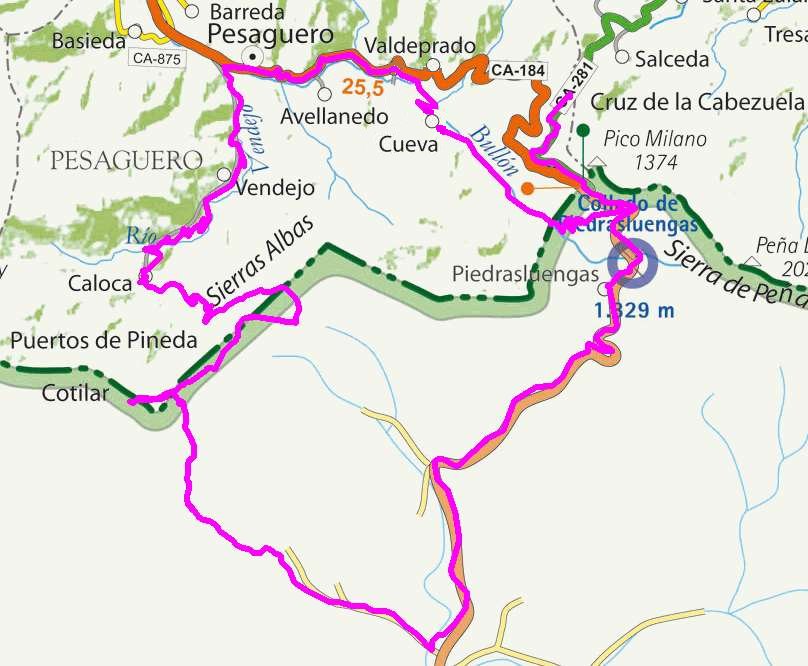
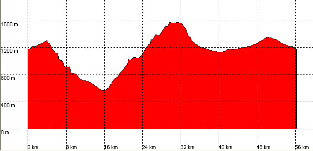
Piedras Luengas, Caloca, Altos de Pineda, Lores

Route 14

By: Javier Tovar, Pedro Ceballos, and Michael González Harbour

Basic Data

Click here to open the route in a Google Maps window. You will see it drawn on a satellite picture or a map. Use the controls in the upper part of the window to zoom into the map, reposition it, or to change the satellite.


Kilometers/Miles
56 / 35
Cummulative ascent: meters/feet
1511 / 4956
Maximum height
1582 / 5190
Duration
5 hours
Beginning and end location
6 Km from the pass of  Piedras Luengas
Difficulty
High
Month
August
Recommended period
Spring, summer

Mapa route 14

Profile

Perfil route 14

Pictures


foto1
foto2
foto 3
foto 4
foto 5
foto 6

Downloads

To open the route in Google Earth click on the 'KMZ' link and select 'Open with Goole Earth' (requires prior installation of Google Earth). To download a route, right-click on the link and select 'save link as' or a similar option.

Instructions

See the instructions and disclaimer, as well as other routes, in the main page.