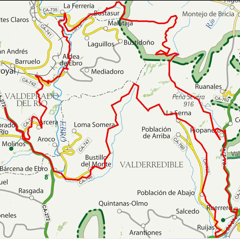
Valdeprado del Río, Aldea de Ebro, Monte Higedo, Ruerrero, La Serna

Route 13

By: Javier Tovar, Pedro Ceballos, and Michael González Harbour

Basic Data

Click here to open the route in a Google Maps window. You will see it drawn on a satellite picture or a map. Use the controls in the upper part of the window to zoom into the map, reposition it, or to change the satellite.


Kilometers/Miles
76 / 47
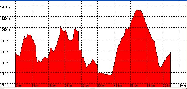
Cummulative ascent: meters/feet
1288 / 4224
Maximum height
1169 / 3834
Duration
7 hours
Beginning and end location
Km 5, road CA-272
Difficulty
High
Month
August
Recommended period
Spring, summer, autum

Mapa route 13

Profile

Perfil route 13

Pictures


foto1
foto2
foto 3
foto 4

Downloads

To open the route in Google Earth click on the 'KMZ' link and select 'Open with Goole Earth' (requires prior installation of Google Earth). To download a route, right-click on the link and select 'save link as' or a similar option.

Instructions

See the instructions and disclaimer, as well as other routes, in the main page.