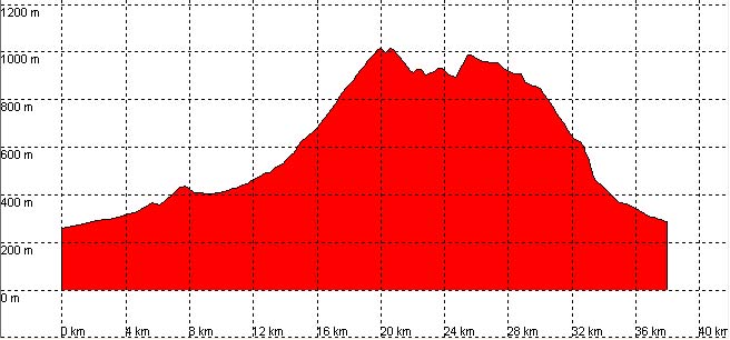
Selores, Correpoco, Ermita del Moral, Viaña

Route 12

By: Javier Tovar, Pedro Ceballos, and Michael González Harbour

Basic Data

Click here to open the route in a Google Maps window. You will see it drawn on a satellite picture or a map. Use the controls in the upper part of the window to zoom into the map, reposition it, or to change the satellite.

Mapa route 11


Kilometers/Miles
38 / 24
Cummulative ascent: meters/feet
946 / 3102
Maximum height
1018 / 3339
Duration
3 and a half hours
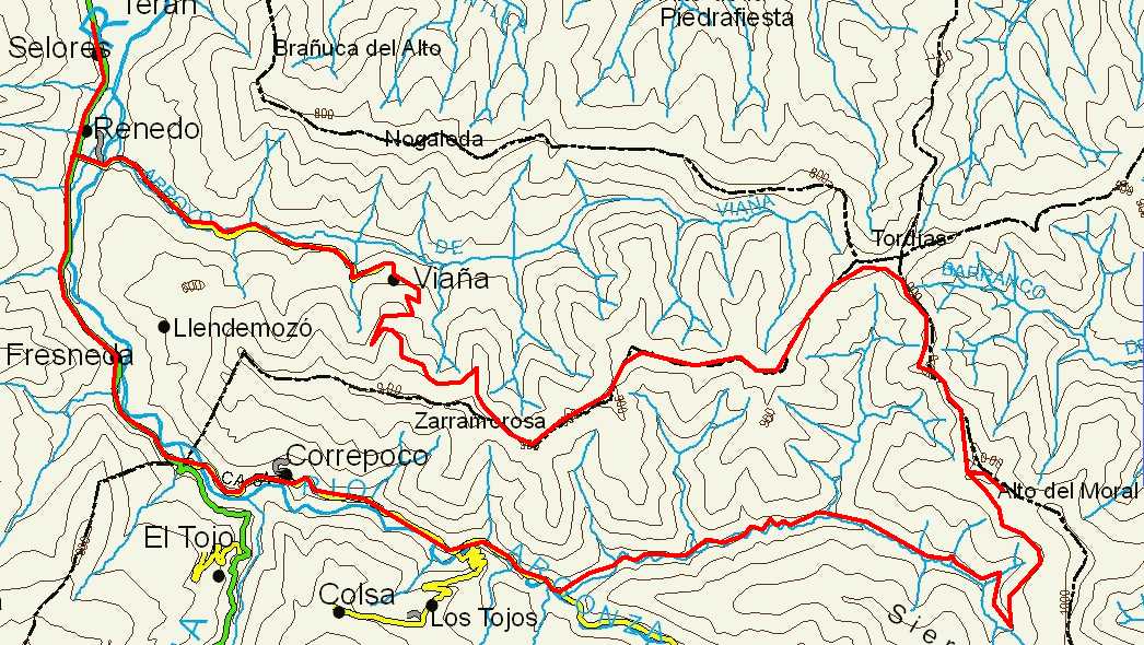
Beginning and end location
Selores
Difficulty
Low
Month
July
Recommended period
Spring, summer, autum

Profile

Perfil route 11

Pictures


foto1
foto2
foto 3
foto 4

Downloads

To open the route in Google Earth click on the 'KMZ' link and select 'Open with Goole Earth' (requires prior installation of Google Earth). To download a route, right-click on the link and select 'save link as' opción similar.

Instructions

See the instructions and disclaimer, as well as other routes, in the main page.