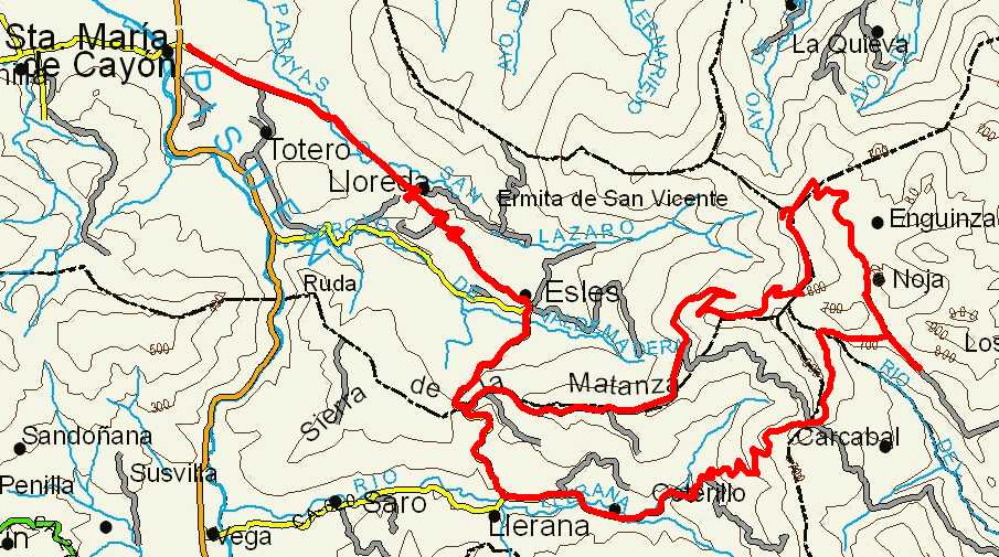
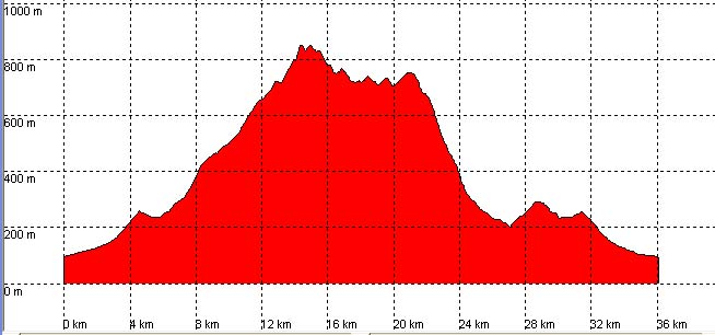
Santa María de Cayón, Esles, Pozos de Noja

Route 11

By: Javier Tovar, Pedro Ceballos, and Michael González Harbour

Basic Data

Click here to open the route in a Google Maps window. You will see it drawn on a satellite picture or a map. Use the controls in the upper part of the window to zoom into the map, reposition it, or to change the satellite.


Kilometers/Miles
36 / 22
Cummulative ascent: meters/feet
1082 / 3549
Maximum height
847 / 2778
Duration
3 hours
Beginning and end location
Santa María de Cayón
Difficulty
Medium
Month
July
Recommended period
All year round

Mapa route 11

Profile

Perfil route 11

Pictures


foto1
foto2
foto 3
foto 4

Downloads

To open the route in Google Earth click on the 'KMZ' link and select 'Open with Goole Earth' (requires prior installation of Google Earth). To download a route, right-click on the link and select 'save link as' opción similar.

Instructions

See the instructions and disclaimer, as well as other routes, in the main page.