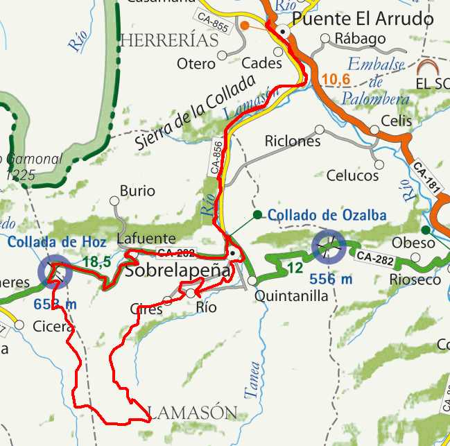
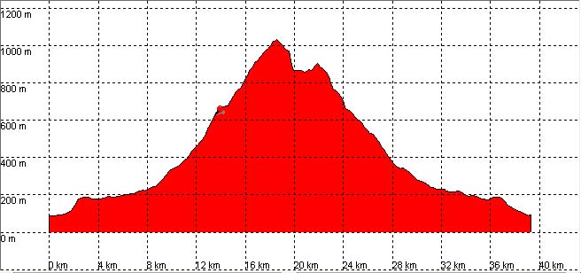
Puente El Arrudo, Cires, Venta de los Lobos, Collado de Hoz

Route 08

By: Javier Tovar, Pedro Ceballos, and Michael González Harbour

Basic Data

Click here to open the route in a Google Maps window. You will see it drawn on a satellite picture or a map. Use the controls in the upper part of the window to zoom into the map, reposition it, or to change the satellite.


Kilometers/Miles
39 / 24
Cummulative ascent: meters/feet
1056 / 3463
Maximum height
1029 / 3375
Duration
4 hours
Beginning and end location
Puente El Arrudo
Difficulty
High
Month
June
Recommended period
Spring-Summer

Mapa route 8

Profile

Perfil route 8

Pictures


foto1
foto2
foto 3
foto 4

Downloads

To open the route in Google Earth click on the 'KMZ' link and select 'Open with Goole Earth' (requires prior installation of Google Earth). To download a route, right-click on the link and select 'save link as' or a similar option.

Instructions

See the instructions and disclaimer, as well as other routes, in the main page.