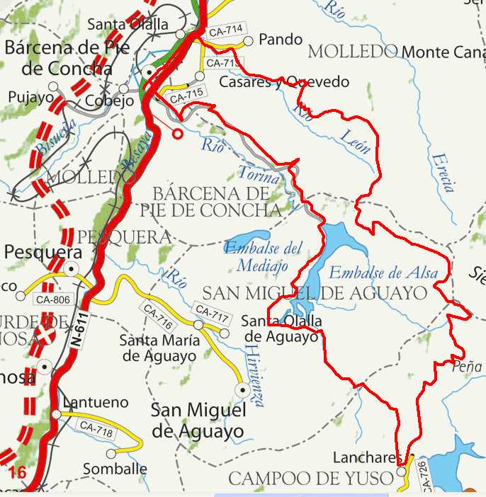
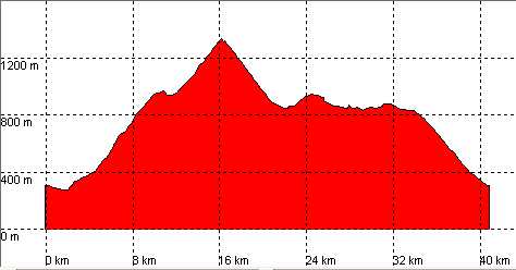
Bárcena de Pie de Concha, Mediumjo Frío, Lanchares, Alsa

Route 06

By: Javier Tovar, Pedro Ceballos, and Michael González Harbour

Basic Data

Click here to open the route in a Google Maps window. You will see it drawn on a satellite picture or a map. Use the controls in the upper part of the window to zoom into the map, reposition it, or to change the satellite.


Kilometers/Miles
42 / 26
Cummulative ascent: meters/feet
1280 / 4200
Maximum height
1325 / 4346
Duration
4 hours
Beginning and end location
Bárcena de Pie de Concha
Difficulty
High
Month
May
Recommended period
Spring-Summer

Mapa route 6

Profile

Perfil route 6

Pictures


foto1
foto2
foto 3
foto 4

Downloads

To open the route in Google Earth click on the 'KMZ' link and select 'Open with Goole Earth' (requires prior installation of Google Earth). To download a route, right-click on the link and select 'save link as' or a similar option.

Instructions

See the instructions and disclaimer, as well as other routes, in the main page.