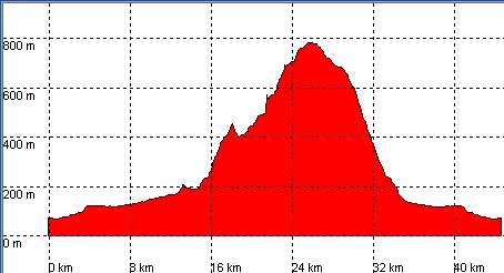
Corrobárceno, San Martín de Toranzo, Collado Gandarillas

Route 03

By: Javier Tovar, Pedro Ceballos, and Michael González Harbour

Basic Data

Click here to open the route in a Google Maps window. You will see it drawn on a satellite picture or a map. Use the controls in the upper part of the window to zoom into the map, reposition it, or to change the satellite.


Kilometers/Miles
44 / 27
Cummulative ascent: meters/feet
831 / 2724
Maximum height
900 / 2952
Duration
3.5 to 4.5 hours
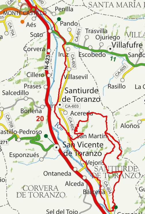
Beginning and end location
Corrobárceno
(Puente Viesgo)
Difficulty
Low
Month
April
Recommended period
All year round

mapa route 3

Profile


perfil route 3

Downloads

To open the route in Google Earth click on the 'KMZ' link and select 'Open with Goole Earth' (requires prior installation of Google Earth). To download a route, right-click on the link and select 'save link as' or a similar option.

Instructions

See the instructions and disclaimer, as well as other routes, in the main page.