Fresneda, Los Tojos, Colsa, Balcón de La Cardosa

Route 02

By: Javier Tovar, Pedro Ceballos, and Michael González Harbour

Basic Data

Click here to open the route in a Google Maps window. You will see it drawn on a satellite picture or a map. Use the controls in the upper part of the window to zoom into the map, reposition it, or to change the satellite.

Kilometers/Miles
46 / 29
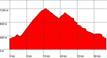
Cummulative ascent: meters/feet
1196 / 3922
Maximum height: meters/feet
1210 / 3970
Duration
5 hours
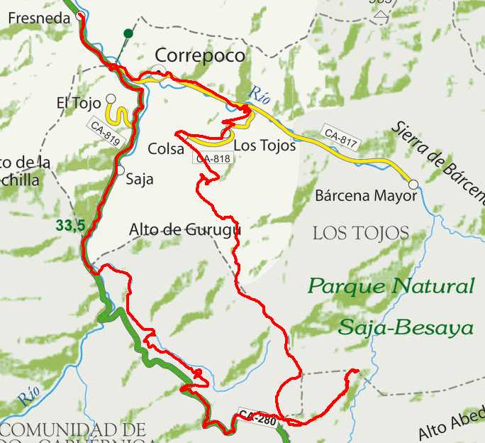
Beginning and end location
Fresneda
Difficulty
Medium
Month
April
Recommended period
Spring, Summer, Autum

mapa route 2

Profile

The steps in the descent are caused by the poor satellite reception at that time.

perfil

Pictures


foto1
foto2

Downloads

To open the route in Google Earth click on the 'KMZ' link and select 'Open with Goole Earth' (requires prior installation of Google Earth). To download a route, right-click on the link and select 'save link as' or a similar option.

Instructions

See the instructions and disclaimer, as well as other routes, in the main page.