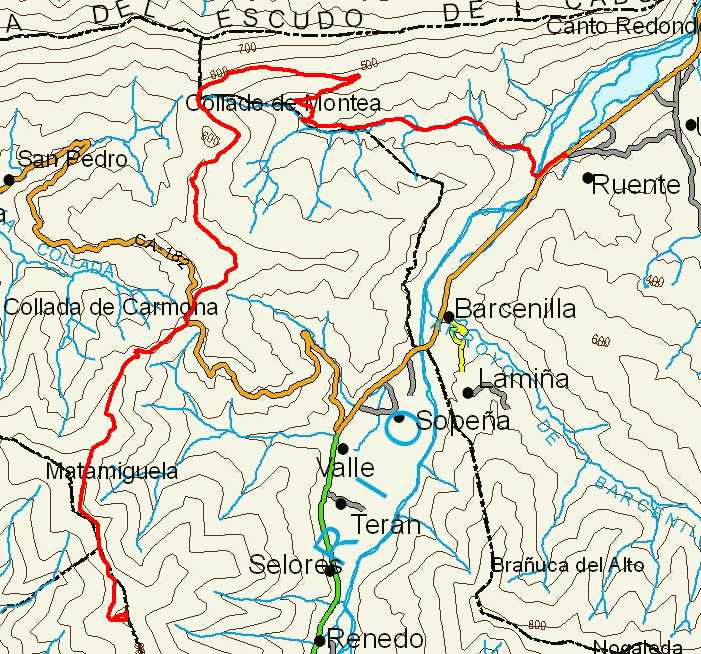
Ruente, Monte AA, Collada de Carmona, and ascent to Zarceillo

Route 01

By: Javier Tovar, Pedro Ceballos, and Michael González Harbour

Basic Data

Click here to open the route in a Google Maps window. You will see it drawn on a satellite picture or a map. Use the controls in the upper part of the window to zoom into the map, reposition it, or to change the satellite.


Kilometers/Miles
35 / 22
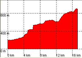
Cummulative ascent: meters/feet
838 / 2748
Maximum height: meters/feet
900 / 2952
Duration
3 to 4 hours
Beginning and end location
Ruente
Difficulty
Low
Month
March
Recommended period
All year round

Mapa de la route 01

Profile

Only the ascent to Zarceillo is shown, as the descent is by the same route.

perfil route 01

Pictures


foto1
foto2

Downloads

To open the route in Google Earth click on the "KMZ" link and select "Open with Goole Earth" (requires prior installation of Google Earth). To download a route, right-click on the link and select "save link as" or a similar option.

Instructions

See the instructions and disclaimer, as well as other routes, in the main page.