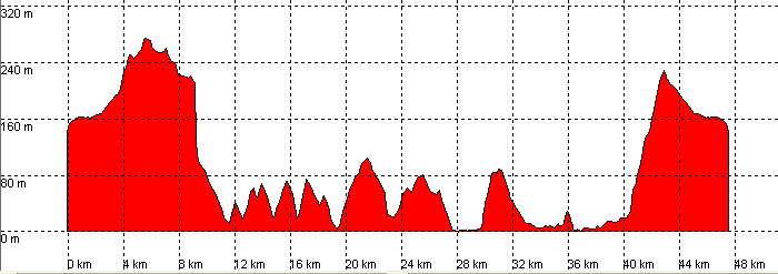
Cabezón de la Sal, Monte Corona, Oyambre, San Vicente de la Barquera

Route 30

By: Javier Tovar, Pedro Ceballos, and Michael González Harbour


Basic Data

Click here to open the route in a Google Maps window. You will see it drawn on a satellite picture or a map. Use the controls in the upper part of the window to zoom into the map, reposition it, or to change the satellite.


route 30 mapa

Kilometers/Miles
48 / 30
Cummulative ascent: meters/feet
907 / 2975
Maximum height: meters/feet
273 / 895
Duration
4 hours
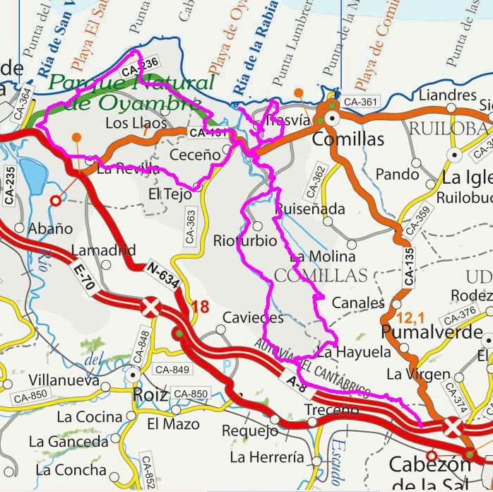
Beginning and end location
Cabezón de la Sal
Difficulty
Low
Month
February
Recommended period
All year round

Profile


perfil route 30

Pictures


foto1
foto2
foto 3
foto 4
foto5
foto 6

Downloads

To open the route in Google Earth click on the 'KMZ' link and select 'Open with Goole Earth' (requires prior installation of Google Earth). To download a route, right-click on the link and select 'save link as' or a similar option.

Instructions

See the instructions and disclaimer, as well as other routes, in the main page.