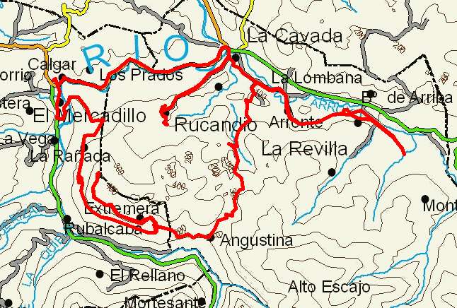
La Cavada, Rucandio, Tetas de Liérganes

Route 26

By: Javier Tovar, Pedro Ceballos, and Michael González Harbour


Basic Data

Click here to open the route in a Google Maps window. You will see it drawn on a satellite picture or a map. Use the controls in the upper part of the window to zoom into the map, reposition it, or to change the satellite.

Kilometers/Miles
31 / 19
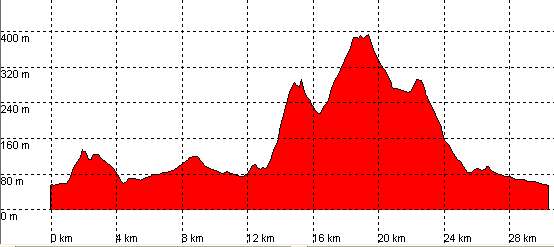
Cummulative ascent: meters/feet
643 / 2109
Maximum height
391 /  1282
Duration
3 hours
Beginning and end location
La Cavada
Difficulty
Low
Month
January
Recommended period
All year round

mapa route 26

Profile


perfil route 26

Pictures


foto1
foto2
foto 3
foto 4
foto5
foto 6

Downloads

To open the route in Google Earth click on the 'KMZ' link and select 'Open with Goole Earth' (requires prior installation of Google Earth). To download a route, right-click on the link and select 'save link as' or a similar option.

Instructions

See the instructions and disclaimer, as well as other routes, in the main page.