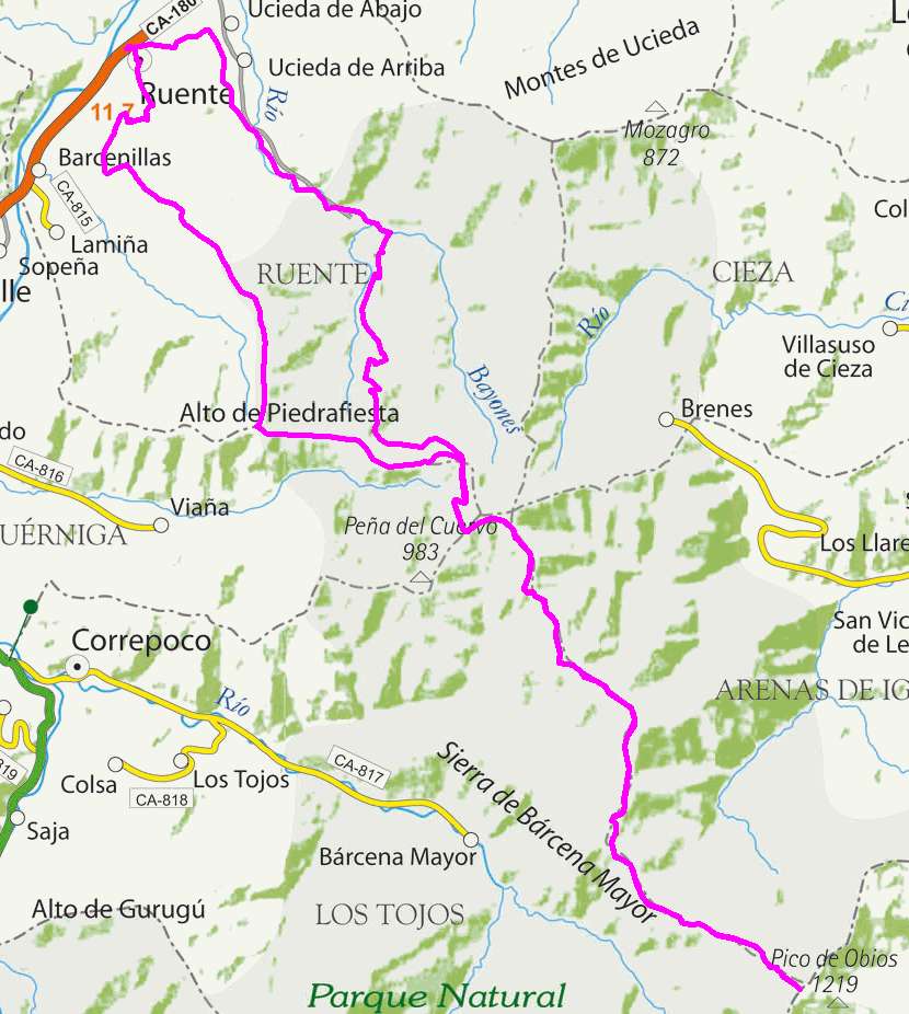
Ruente, Ermita del Moral, Obios

Route 25

By: Javier Tovar, Pedro Ceballos, and Michael González Harbour

Basic Data

Click here to open the route in a Google Maps window. You will see it drawn on a satellite picture or a map. Use the controls in the upper part of the window to zoom into the map, reposition it, or to change the satellite.

mapa route 25

Kilometers/Miles
52 / 32
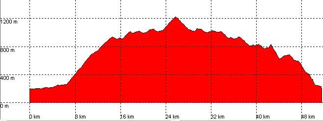
Cummulative ascent: meters/feet
1490 / 4887
Maximum height
1218 / 3995
Duration
5 hours
Beginning and end location
Ruente
Difficulty
Medium
Month
January
Recommended period
Spring-Summer-Autum

Profile


perfil route 25

Pictures


foto1
foto2
foto 3
foto 4
foto5
foto 6

Downloads

To open the route in Google Earth click on the 'KMZ' link and select 'Open with Goole Earth' (requires prior installation of Google Earth). To download a route, right-click on the link and select 'save link as' or a similar option.

Instructions

See the instructions and disclaimer, as well as other routes, in the main page.