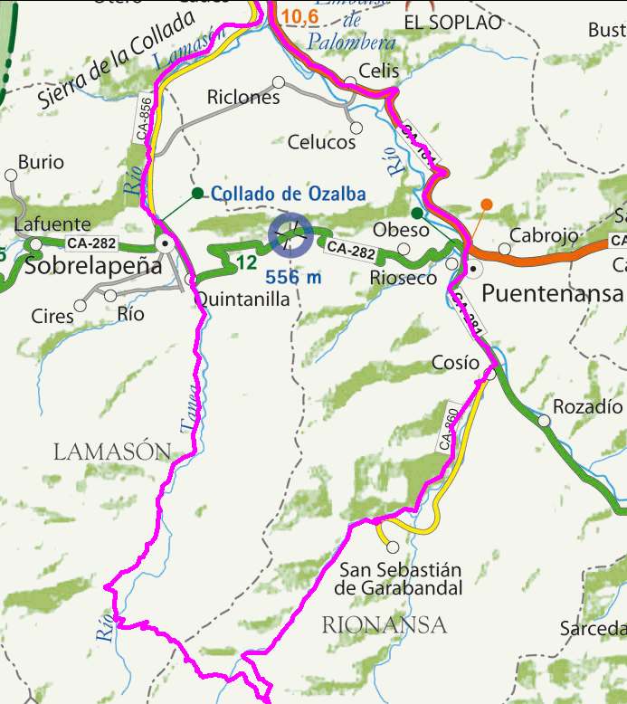
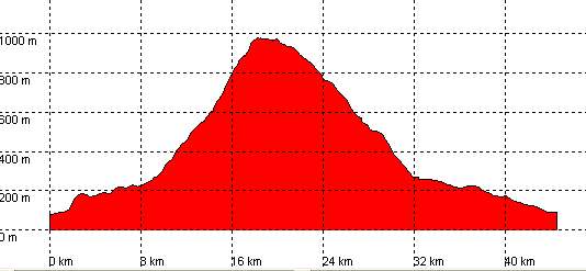
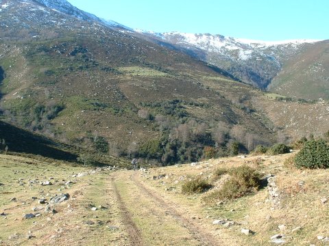
Puente el Arrudo, Río Tanea, Collado de la Carrizosa, San Sebastián de Garabandal

Route 24

By: Javier Tovar, Pedro Ceballos, and Michael González Harbour


Basic Data

Click here to open the route in a Google Maps window. You will see it drawn on a satellite picture or a map. Use the controls in the upper part of the window to zoom into the map, reposition it, or to change the satellite.

Kilometers/Miles
45 / 28
Cummulative ascent: meters/feet
992 / 3253
Maximum height
975 / 3198
Duration
4 and a half hours
Beginning and end location
Puente El Arrudo
Difficulty
Medium
Month
December
Recommended period
All year round

mapa route 24

Profile


perfil route 24

Pictures


foto1
foto2
foto 3
foto 4
foto5
foto 6

Downloads

To open the route in Google Earth click on the 'KMZ' link and select 'Open with Goole Earth' (requires prior installation of Google Earth). To download a route, right-click on the link and select 'save link as' or a similar option.

Instructions

See the instructions and disclaimer, as well as other routes, in the main page.