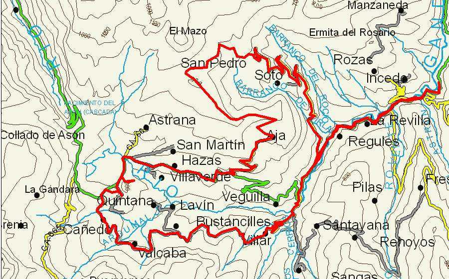
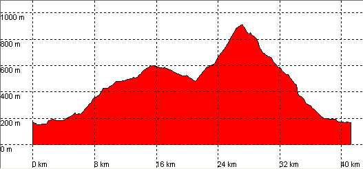
La Revilla, Bustancillés, La Gándara, Aja, San Pedro

Route 23

By: Javier Tovar, Pedro Ceballos, and Michael González Harbour


Basic Data

Click here to open the route in a Google Maps window. You will see it drawn on a satellite picture or a map. Use the controls in the upper part of the window to zoom into the map, reposition it, or to change the satellite.

Kilometers/Miles
42 / 26
Cummulative ascent: meters/feet
968 / 3175
Maximum height
907 / 2975
Duration
3 and a half hours
Beginning and end location
Road CA-256 from Ramales to La Revilla
Difficulty
Low
Month
December
Recommended period
All year round

mapa route 23

Profile


perfil route 23

Pictures


foto1
foto2
foto 3
foto 4
foto5
foto 6

Downloads

To open the route in Google Earth click on the 'KMZ' link and select 'Open with Goole Earth' (requires prior installation of Google Earth). To download a route, right-click on the link and select 'save link as' or a similar option.

Instructions

See the instructions and disclaimer, as well as other routes, in the main page.