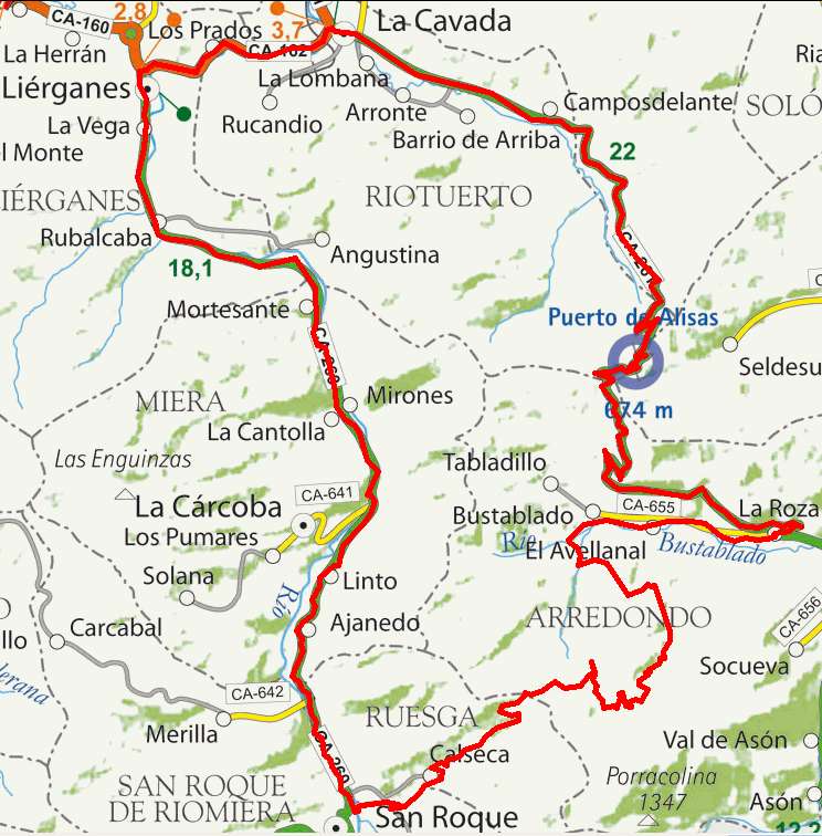
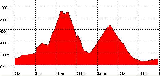
Rubalcaba, Alto de Somo, Bustablado, Puerto de Alisas

Route 22

By: Javier Tovar, Pedro Ceballos, and Michael González Harbour

Basic Data

Click here to open the route in a Google Maps window. You will see it drawn on a satellite picture or a map. Use the controls in the upper part of the window to zoom into the map, reposition it, or to change the satellite.

Kilometers/Miles
57 / 35
Cummulative ascent: meters/feet
1520 / 4985
Maimum height
914 / 3089
Duration
4 and a half hours
Beginning and end location
Rubalcaba
Difficulty
High
Month
November
Recommended period
Todo el año

Mapa route 22

Profile

The step in the first ascent is due to the low number of satellites that the GPS was capturing at that time.

Perfil route 22

Pictures


foto1
foto2
foto 3
foto 4
foto5
foto 6

Downloads

To open the route in Google Earth click on the 'KMZ' link and select 'Open with Goole Earth' (requires prior installation of Google Earth). To download a route, right-click on the link and select 'save link as' or a similar option.

Instructions

See the instructions and disclaimer, as well as other routes, in the main page.