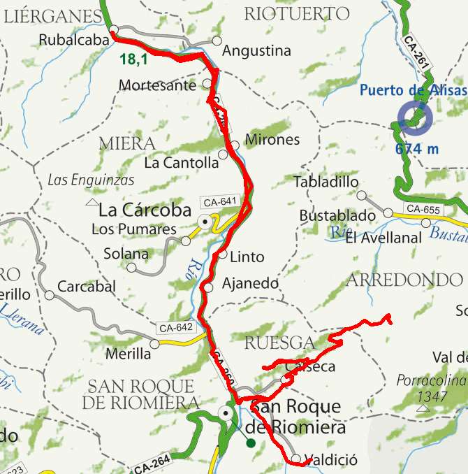
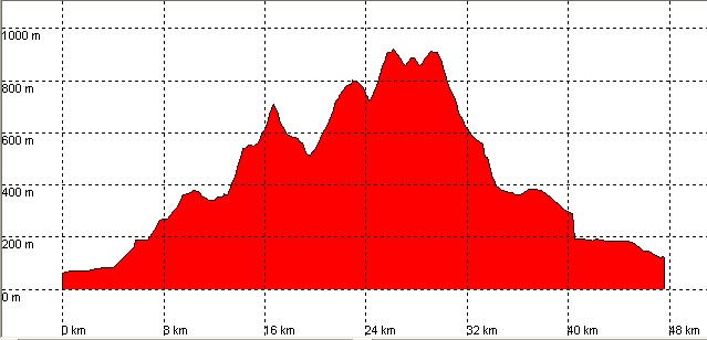
Rubalcaba, Valdició, Calseca, Alto de Somo

Route 20

By: Javier Tovar, Pedro Ceballos, and Michael González Harbour


Basic Data

Click here to open the route in a Google Maps window. You will see it drawn on a satellite picture or a map. Use the controls in the upper part of the window to zoom into the map, reposition it, or to change the satellite.

Kilometers/Miles
48 / 30
Cummulative ascent: meters/feet
1316 / 4316
Maximum height
917 / 3007
Duration
4 hours
Beginning and end location
Rubalcaba
Difficulty
High
Month
October
Recommended period
All year round

Mapa route 20

Profile

The step in the last descent is due to the low number of satellites that the GPS was capturing at that time.

perfil route 20

Pictures


foto1
foto2
foto 3
foto 4
foto5
foto 6

Downloads

To open the route in Google Earth click on the 'KMZ' link and select 'Open with Goole Earth' (requires prior installation of Google Earth). To download a route, right-click on the link and select 'save link as' or a similar option.

Instructions

See the instructions and disclaimer, as well as other routes, in the main page.