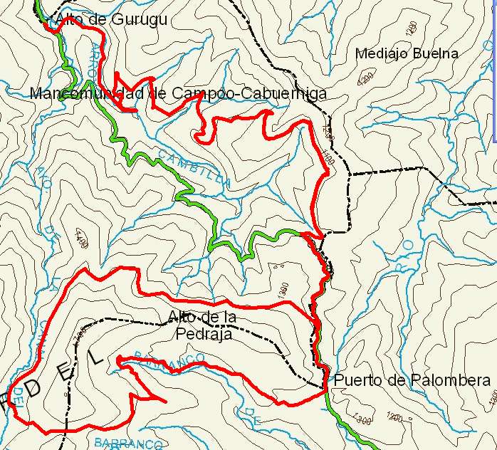
Saja, Ozcaba, Llano Castrillo, Rumaceo, Puerto de Palombera

Route 18

By: Javier Tovar, Pedro Ceballos, and Michael González Harbour

Basic Data

Click here to open the route in a Google Maps window. You will see it drawn on a satellite picture or a map. Use the controls in the upper part of the window to zoom into the map, reposition it, or to change the satellite.

Kilometers/Miles
50 / 31
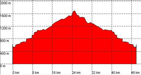
Cummulative ascent: meters/feet
1443 / 4733
Maximum height
1684 / 5524
Duration
4 and a half hours
Beginning and end location
Saja
Difficulty
Medium
Month
October
Recommended period
Summer

Mapa route 18

Profile

Perfil route 18

Pictures


foto1
foto2
foto 3
foto 4

Downloads

To open the route in Google Earth click on the 'KMZ' link and select 'Open with Goole Earth' (requires prior installation of Google Earth). To download a route, right-click on the link and select 'save link as' or a similar option.

Instructions

See the instructions and disclaimer, as well as other routes, in the main page.